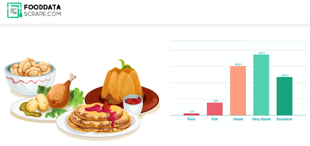
Do you want a comprehensive list of restaurants with reviews and locations every time you visit a new place or go on vacation? Sure you do, because it makes your life so much easier. Data scraping is the most convenient method.
Web scraping, also known as data scraping, is the process of transferring information from a website to a local network. The result is in the form of spreadsheets. So you can get a whole list of restaurants in your area with addresses and ratings in one simple spreadsheet! In this blog, you will learn how to use Python and Google Colab to Extract food data From Google Maps.
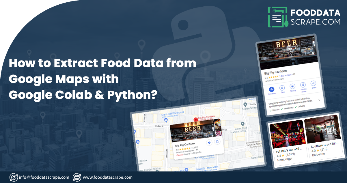
WWe are scraping restaurant and food data using Python 3 scripts since installing Python can be pretty handy. We use Google Colab to run the proofreading script since it allows us to run Python scripts on the server.
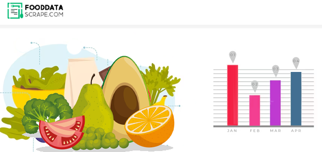
As our objective is to get a detailed listing of locations, extracting Google Maps data is an ideal solution. Using Google Maps data scraping, you can scrape data like name, area, location, place types, ratings, phone numbers, and other applicable information. For startups, we can utilize a places data scraping API. A places Scraping API makes that very easy to scrape location data.
Step 1: What information would you need?
For example, here we are searching for "restaurants near me" in Sanur, Bali, within 1 kilometer. So the criteria could be "restaurants," "Sanur Beach," and "1 mile."Let us convert this into Python:
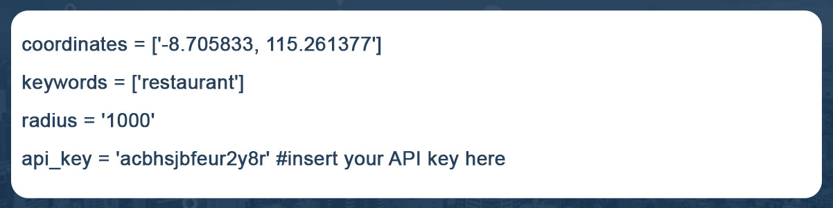
These "keywords" help us find places categorized as restaurants OR results that contain the term "restaurant." A comprehensive list of sites whose names and types both have the word "restaurant" is better than using "type" or "name" of places.
For example, we can make reservations at Se'i Sapi and Sushi Tei at the same time. If we use the term "name," we will only see places whose names contain the word "restaurant." If we use the word "type," we get areas whose type is "restaurant." However, using "keywords" has the disadvantage that data cleaning takes longer.
Step 2: Create some necessary libraries, like:
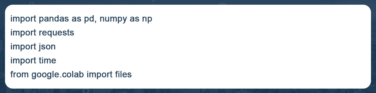
Create some necessary modules, such as:
The "files imported from google. colab" did you notice? Yes, to open or save data in Google Colab, we need to use google. colab library.
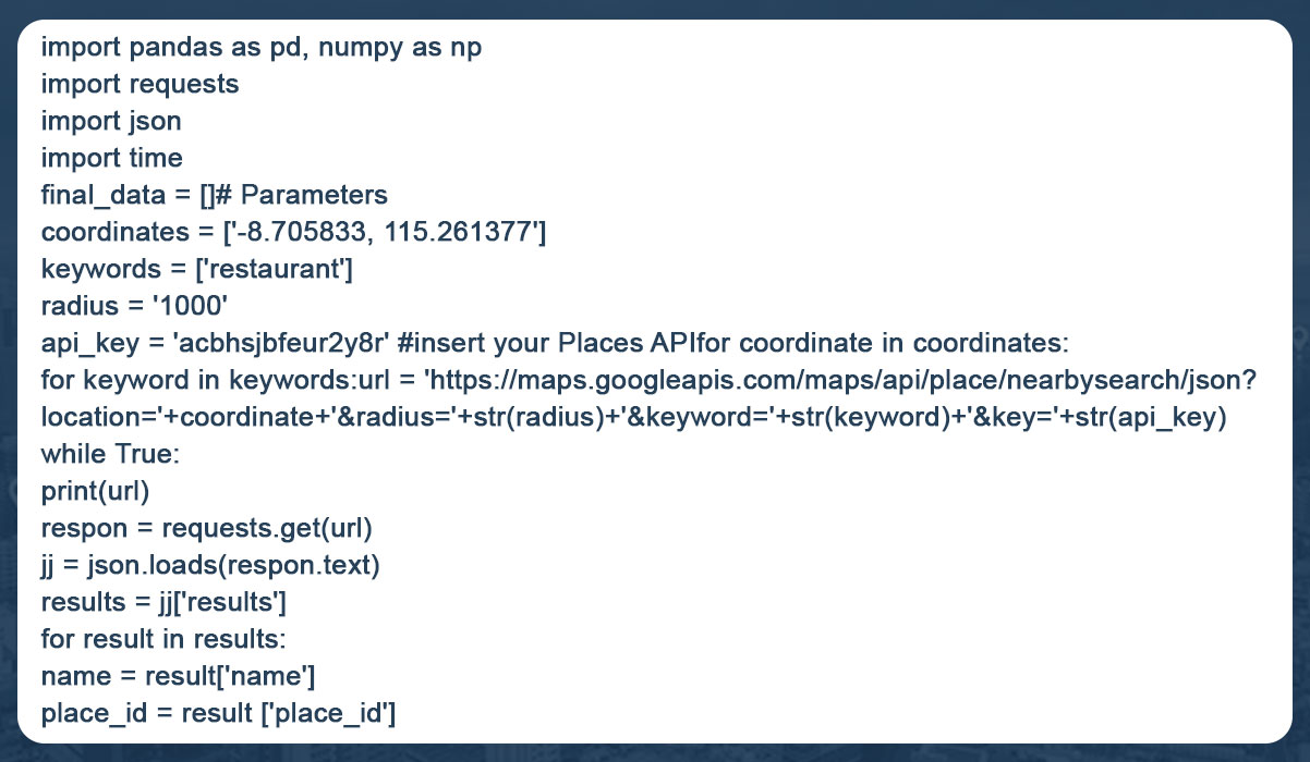
Step 3: Create a piece of code that generates data based on the first Step's variables.
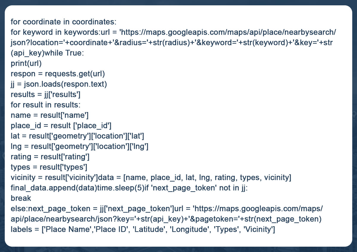
With this code, we get the location's name, longitude, latitude, IDs, ratings, and area for each keyword and coordinate. Suppose there are 40 locales near Sanur; Google will output the results on two pages. If there are 55 results, there are three pages. Since Google only shows 20 entries per page, we need to specify the 'next page token' to retrieve the following page data.
The maximum number of data points we retrieve is 60, which is Google's policy. For example, within one kilometer of our starting point, there are 140 restaurants. This means that only 60 of the 140 restaurants will be created.
So, to avoid inconsistencies, we need to get both the radius and the coordinates right. Ensure that the diameter is not too large so that "only 60 points are created, although there are many of them". Also, ensure the radius is manageable, as this would result in a long list of coordinates. Neither can be efficient, so we need to capture the context of a location earlier.
Continue reading the blog to learn more how to extract data from Google Maps using Python.
Step 4: Store information on the user's computer
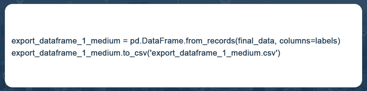
Final Step: To integrate all these procedures into a complete code:
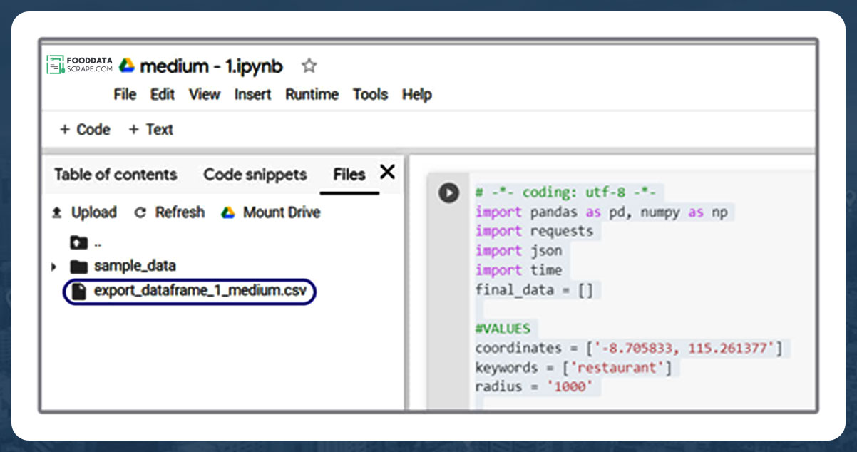
You can now quickly download data from various Google Colab files. To download data, select "Files" after clicking the arrow button in the left pane!
Your data will be scraped and exported in CSV format, ready for visualization with all the tools you know! This can be Tableau, Python, R, etc. Here we used Kepler.gl for visualization, a powerful WebGL-enabled web tool for geographic diagnostic visualizations.
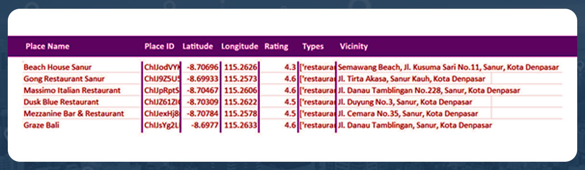
The data is displayed in the spreadsheet as follows:
In the Kepler.gl map, it is shown as follows:
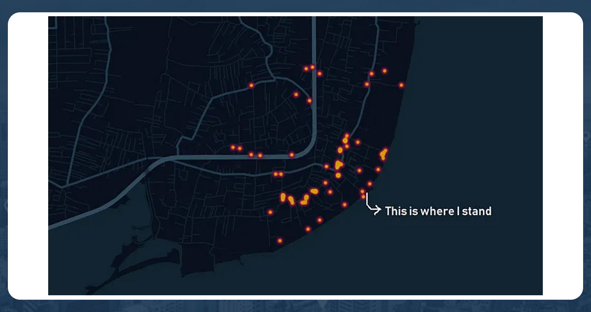
From our location, lounging on Sanur beach, there are 59 nearby eateries. Now we can explore our neighborhood cuisine by adding names and reviews to a map!
Conclusion:
Food data extraction using Google Maps, Python, and Google Colab can be an efficient and cost-effective way to obtain necessary information for studies, analysis, or business purposes. However, it is important to follow Google Maps' terms of service and use the data ethically and legally. However, you should be aware of limitations and issues, such as managing web-based applications, dealing with CAPTCHA, and avoiding Google blocking.
Are you looking for an expert Food Data Scraping service provider? Contact us today! Visit the Food Data Scrape website and get more information about Food Data Scraping and Mobile Grocery App Scraping.